What's new
Fantasy Football - Footballguys Forums

This is a sample guest message. Register a free account today to become a member! Once signed in, you'll be able to participate on this site by adding your own topics and posts, as well as connect with other members through your own private inbox!

Official 2023 Atlantic Hurricane Thread - Tammy (1 Viewer)

I think I'd be a lot more worried if I were on Long Island than in the Carolinas at this point.

IMO the takeaway from this thing is that climate change has produced conditions where going from not having a threat at all to a Cat 5 in just a few days will become more common.

If that happened with a landfalling hurricane it would add new problems with preparations and evacuations.
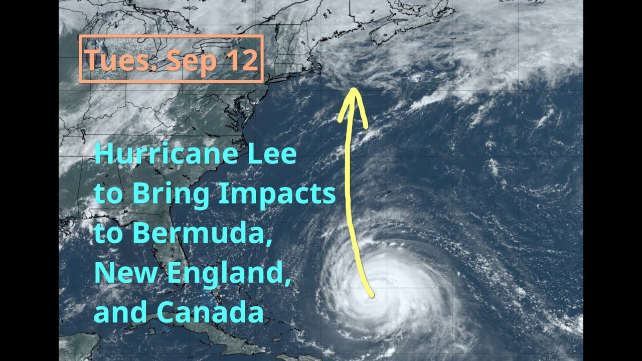
It's the Caribbean cruiser that has this risk. A cape Verde storm is not going to sneak up on us.
 
Nhc has said in nearly every advisory they are behind the models.
Not sure what you mean. That tweet (yeah it's a tweet, not an X) is pointing out that from 12z today +36 hours NHC forecast has it at Cat 5, which is unprecedented.
The nhc has text with each advisory and they have had comments that they felt the numbers they were publishing would be low.
Right, and if I'm reading it right the tweet has nothing to do with NHC being conservative, maybe more to the opposite.
 
Recon fight finding numbers that put it at or near cat5. Maybe those "crazy" numbers from HAFS aren't so crazy.
 
Now they forecast for 180mph which will probably be low. Could challenge the record for wind speed (Atlantic).
 
Weakened overnight due to shear. May see two days like this then make one more run at history
Not sure it did. If you're getting that from the Eric Webb tweet there was a reply that corrected it, but it has stopped intensifying. It is going to weaken though and like you said bounce back up and down.
 
Still no turn in the HAFS models but it looks like it's starting to show that opening to the north. Closer it gets to 70W at +126 hour the more nail biting I'm doing. I'm about out of nails.
 
HAFS seeing the right hand (aka north) turn now so that's good, and in agreement with the others.
 
Not prepping in any way so it'll probably be another one of those storms that causes us to lose power for a week.
 
Phillipe

Tropical storm that models currently have curving North at sea.
Models are all over the place here, some have it just dissipating from shear, some have it running off. Shear is tricky to forecast. Keep an eye on this thru the weekend at least if in FL
Yeah Phillipe definitely changed his mind from Sunday. Now looks like he is slowing down for the weekend and making a hard right Mon/Tue
 

Users who are viewing this thread

Back
Top